Newark, Sutton and Westmore; Caledonia and Orleans Counties 7,682 Acres
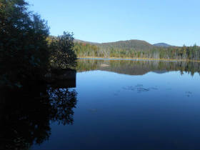
Dolloff Pond (Photo Credit - Friends of Willoughby)
General Description:
Willoughby State Forest is easily accessible from State Routes 5 and 5A and is bisected by Lake Willoughby, with Mount Hor (2648 feet) to the west and Mount Pisgah (2751 feet) to the east. It is located on the divide between the Saint Lawrence and Connecticut River watersheds.
Unique Features: The most spectacular attraction of this area is Lake Willoughby and the adjacent cliffs of Mount Hor (2648 feet) and Mount Pisgah (2751 feet) that rise from the lake. This area possesses significant ecological, recreational, and aesthetic values. The highest peak in the forest is Bald Mountain at 3315 feet in elevation. Lake Willoughby is 1653 acres in size with a maximum depth of 308 feet, making it one of the deepest lakes in the northeastern United States.
Willoughby State Forest contains two natural areas – Willoughby Cliffs Natural Area in Westmore (950 acres) and Marl Pond and Swamp Natural Area in Sutton (30 acres). For more information, see the Vermont Natural Areas Guide.
Recreation Overview:
Please note that bicycles are ONLY allowed on gravel surfaced roads (the CCC Road, Duck Pond Road) within Willoughby State Forest and NOT on hiking trails.
There are no designated camping sites within the forest and no facilities other than the portable toilet units at the South End during the summer and the unit at the CCC Road trailhead year-round. Car camping or RV camping is NOT allowed at Willoughby State Forest. Only primitive camping may take place within the Forest. Camping near the lake is NOT an allowed use.
Willoughby State Forest is available for dispersed recreational activities, including hiking, primitive camping, cross country skiing, snowshoeing, hunting and fishing. There are over 12 miles of hiking trails on the forest and numerous ponds for swimming and fishing. Most of the trails are well suited to the novice and intermediate hiker. Several other trails are located on adjacent private ownerships. These trails are maintained by the Westmore Association and Northwoods Stewardship Center and are described in the “Day Hikers Guide to Vermont” published by the Green Mountain Club (GMC). These trails are located on Wheeler, Bald, and Haystack Mountains.
Willoughby State Forest includes approximately 12 kilometers of groomed Nordic terrain around Bartlett Mountain - suitable for both classic and skate skiing. Weather permitting, the trails are groomed through the winter months (generally late December to mid-March) by the NorthWoods Stewardship Center. In addition, Vermont FPR is working with the Northeast Kingdom Backcountry Coalition (NEKBC), a chapter group of the Vermont Backcountry Alliance, to develop a variety of ungroomed backcountry ski terrain, including both gladed trails and narrow ‘skin tracks’. NEKBC manages gladed lines on Mt. Hor, Bartlett Mountain, and the lower CCC Road. These glades are part of a pilot effort to provide a greater diversity of backcountry terrain on public lands while reducing illegal cutting. Any unauthorized removal of forest vegetation is prohibited.
- FPR Recreation Page
- Primitive Camping Map
- Hiking Information
- Nordic Ski Trail Brochure
- Nordic Ski Trail Map
- Summer Kiosk Map
Planning Overview: The long-range management plan for the Willoughby State Forest is complete and being implemented annually. It was adopted in 2004 and amended in 2012, 2015, and 2025.
- Final Long Range Management Plan
- Cover Page
- Changes to Draft Plan Included in Final Plan
- Locator Map
- Base Map
- Land Classification Map
- Duck Pond/Blake Pond Recreation Area
- Timber Harvesting Schedule
- South End Intensive Use Map
- Bedrock Geology Map
- Natural Communtities Map
- Wildlife Habitat Map
- Timber Assessment Map
- Public Access Map
- Lakes and Ponds Access Assessment
- Cultural/Historic Resources
- Legal Constraints