Plymouth; Windsor County 295 Acres

For more information about this unit please visit the web page:
General Description:
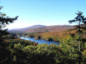
Camp Plymouth State Park is southern Vermont’s most visited state park. It features swimming, picnicking, group camping, and pavilion and cottage rentals along the eastern shore of Echo Lake within the Town of Plymouth, Vermont. The park is located just over one mile from Route 100 with access provided by Scout Camp Road (Town Highway #42), a paved town road that bisects the property. Echo Lake and Buffalo Brook are the two dominant natural features associated with the park. Echo Lake is approximately 96 acres in size and is the middle lake in a chain of three lakes connected by the Black River along the Plymouth-Ludlow town line. Camp Plymouth State Park contains approximately 3,300 feet of shoreline on Echo Lake. Buffalo Brook forms a large portion of the park’s northern boundary and flows through the center of the park where, over the course of many centuries, it has carved out a small ravine before emptying into Echo Lake.
Unique Features:
One rare natural community is found within the park – a 20-acre example of a Sugar Maple-Ostrich Fern Riverine Floodplain Forest located along the lower end of Buffalo Brook and along the shore of Echo Lake. Three rare aquatic plants – water milfoil, Farwell’s milfoil, and straight-leaf pondweed have been found in Echo Lake though not in the area adjacent to the park. Several vernal pools and seeps occur on the hillside above the park itself. The Buffalo Brook drainage east of the park entrance is a scenic area for exploration and a popular destination for amateur gold panning. Approximately 75 acres of Hemlock or mixed Hemlock-Northern Hardwood Forest within the park have been mapped by the Vermont Fish & Wildlife Department as deer wintering habitat.
Recreation Overview:
Most visitation to the park occurs in the lakeside day use area that features a beach, playground, picnic area, and boat rentals. Additional recreation occurs in the remaining undeveloped regions of the park that abuts the 7,788-acre Arthur Davis Wildlife Management Area owned by the Vermont Fish & Wildlife Department.
- The Vista Trail (Trail Finder)
- Arthur Davis Wildlife Management Area
- Information on hunting, fishing and trapping in Vermont
- Using State Lands for Recreation
- FPR Recreation Activities
- Camp Plymouth State Park on Echo Lake
Planning Overview:
The LRMP for the parcel is current and being actively implemented.
- Camp Plymouth State Park LRMP (March 2004)
- Plan Table of Contents
- Plan Appendices
- Biophysical Regions of Vermont Map
- Base Map
- Natural Communities Map
- Wildlife Resources Map
- Cultural/Historic Resources Map
- Recreational Opportunities Map
- Recreation Map
- Forest Stands Map
- Legal Constraints Map
- Land Use Classification Map
- Soil Productivity Map
- Soils Type Map
- Vegetation Management Map
- Topographic Map
- Orthophoto
- Additional Historic Photos
- 1971 Hand Drawn Map of Camp Plymouth
