 Present-day satellite photos of Vermont show a heavily forested landscape, where the ridges of the Green Mountains are hedged by dense forests. With the exception of the Champlain and Connecticut River Valleys, forest cover in Vermont is broken up only by slivers of farmland along the state’s major rivers and the occasional hill farm.
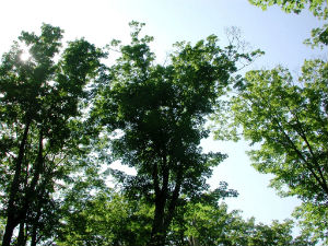
Our great-grandparents would hardly recognize the Vermont we have grown accustomed to; many of the hay fields, pastures, barns, and homes of their youth are all but memories today. In their place stand forests of tall white pine, white ash, red oak, and sugar maple.
Through the use of ongoing inventory, monitoring and reporting we are able to document changes in forest health, productivity and sustainability over time. The Department of Forests, Parks and Recreation (FPR) conducts or assists with a number of these efforts:
- Forest Inventory and Analysis (FIA) Program: Since the 1940s, state and federal agencies have been collecting and reporting information on Vermont's forest resources and their use. The Forest Inventory and Analysis (FIA) Program of the USDA Forest Service are responsible for collecting and analyzing forest resource information for the entire United States.
- Forest Resource Harvest Reports: Annual Forest Resource Harvest Reports are produced by FPR and provide a picture of what, where and how our forest resources are being utilized.
- Stumpage Price Reports: The Quarterly Stumpage Price Reports summarize data on the prices paid for standing timber and reported to the FPR during the previous calendar quarter (previous years’ data are available on request).
- Forest Health: The health of Vermont’s forest resource is monitored by periodic measurements of tree condition and other ecosystem parameters like soils, indicator plants, and vegetation structure.
- Forest Action Plan and State Assessment: To create Vermont's Forest Action Plan, FPR conducted a detailed state assessment that provides valuable information to plan for our future forests.
- ANR Mapping Tools and Maps: The Vermont Agency of Natural Resources hosts online mapping tools, ANR Atlas and BioFinder, and maps.
- Natural Communities: The Fish and Wildlife Department hosts information on natural community inventories.
- Vermont Woodland Owner Survey 2014: The Vermont Woodland Owner Survey final report describes Vermont landowner characteristics, attitudes, and behaviors related to their forested land. The report was prepared by the Family Forest Research Center.