Current Conditions: Fire Danger Forecasting will resume on March 20, 2025.
Understanding Fire Danger:
Green (Low)
A green rating indicates that the fire danger potential in an area is low. This means that fires are unlikely to start, but if they do, weather and fuel conditions will make it difficult for them to spread quickly. As such, any fires should be low in intensity and easy to control.
Blue (Moderate)
A blue rating indicates that fire danger potential is moderate. This means that there is potential for fires to start from common accidental causes, but fire incidents are still relatively rare.
Fires that do start in these areas are moderate in intensity, flame length, and rate of spread. However, control is still typically not difficult and requires light to moderate clean-up.
Yellow (High)
A high fire danger rating is indicated by the color yellow. These fires present high potential for danger, and fires can easily start in fine fuels like grass, needles, and debris. Fires in dry fields and leaf litter are difficult to control, particularly in windy conditions. Outdoor burning should be avoided when possible.
Orange (Very High)
Orange signifies a very high fire danger rating, and fires in these areas start easily from all causes, often spreading faster than suppression resources can be delivered. Flame lengths are typically long and high in intensity. Controlling these fires is very difficult. Outdoor burning is not recommended in orange rated areas.
Red (Extreme)
Extreme fire danger is indicated by the color red. Fires in these areas start very easily, burn intensely, and spread rapidly. Small fires typically grow at a very fast rate. These fires are very difficult to control, often last for several days, and can become very dangerous. No outdoor burning should take place in areas with a red fire danger rating.
Today’s fire weather forecast from the National Weather Service is available at this link: Fire Weather Forecast.
Note: This link includes the forecast for Bennington and Windham counties (scroll down the page to view).
Forecasts are also available from these resources: 
National Weather Service, Burlington VT
National Weather Service, Albany NY
For more information on fire danger and current conditions contact:
Wildland Fire Program staff with the Vermont Department of Forests, Parks & Recreation.
For more information about wildland fire risk see the Eastern Area Wildland Long-Term Assessment
Open burning requires a permit from the Town Forest Fire Warden unless there is snow surrounding the open burning site. However, many towns have local ordinances that require a permit year-round. Always check with your town fire warden before burning.
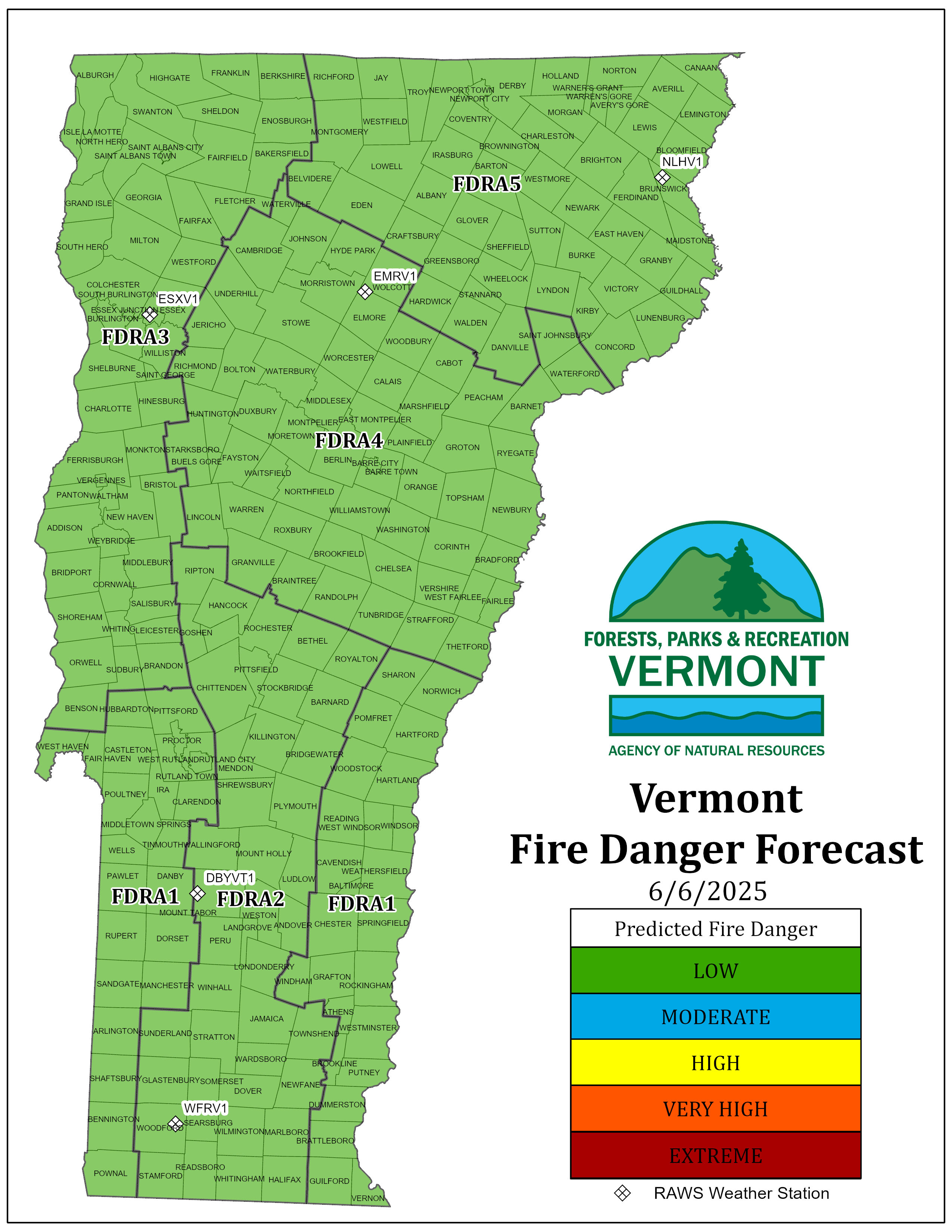
Vermont is divided up into 5 Fire Danger Rating Areas (FDRA). A Fire Danger Rating Area is a geographic area relatively similar in climate, fuels and topography, within which the fire danger can be assumed to be uniform. Its size and shape is based on influences of fire danger, not political boundaries. Click here for a List of Towns in Each Fire Danger Rating Area.
Wildland fire danger ratings are determined by comparing forest fuel conditions, recent weather conditions, and various fire start risk factors. During non-snow periods of the year, the Department of Forests, Parks and Recreation monitors forest fire danger levels daily.
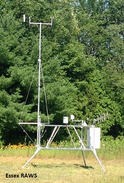 Fire danger in Vermont is calculated based on the National Fire Danger Rating System (NFDRS). Input into the NFDRS model comes from weather observations from five remote automated weather stations (RAWS) located as follows (Note: Weather observations are listed in Greenwich Mean Time (GMT), add 4 hours to current EDST (Eastern Daylight Savings Time to get GMT.):
In addition to the Vermont fire danger monitoring program, the National Weather Service also provides fire weather products including daily fire weather forecasts, spot forecasts for on-going fires, fire weather watches, and Red Flag warnings. Vermont is covered by two National Weather Service offices:
National Weather Service - Burlington, Vermont, which covers all of Vermont except Bennington and Windham Counties
National Weather Service - Albany, New York, which covers Bennington and Windham Counties
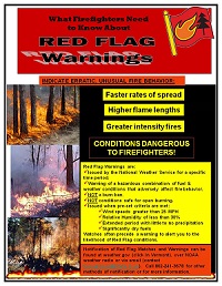
What is a Red Flag warning? Follow this link for more information on how dry fuels and weather conditions combine to create erratic and hazardous fire behavior that can be dangerous to firefighters. This list provides links to find out when these warnings are issued and how to be notified. The poster, "What Firefighters Need to Know About Red Flag Warnings" is a good reminder for firefighters. This print ready version is available for your use. Post a copy in your fire station!