Winhall & Londonderry; Bennington & Windham Counties 914 Acres

For more information about this unit please visit the web page:
General Description:
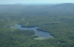
Gale Meadows Wildlife Management Area (WMA) is an approximately 707-acre parcel located in the towns of Londonderry and Winhall. It is owned by the State of Vermont and managed by the Vermont Fish & Wildlife Department. It includes a 195-acre man-made pond that averages 8 feet deep and has a maximum depth of about 20 feet. The principal tributary to the pond is Mill Brook. The terrain on Gale Meadows WMA is gently rolling. It contains forested wetlands, several small meadows, and forest cover of mostly softwoods such as white pine, red spruce, balsam fir, and hemlock.
Unique Features:
Much of the land provides habitat for deer, including approximately 50 acres of deer-wintering area.The pond and surrounding lands are used by a variety of wildlife. Rare species found within Gale Meadows WMA include Eastern pearlshell mussel, low water milfoil, and there has been one sighting of a black-backed woodpecker. Significant natural communities within Gale Meadows WMA include spruce-fir tamarack swamp, dwarf shrub bog, vernal pools, and seeps. The property and pond can be accessed by the developed boat launch located at the easternmost point of the pond off Haven Hill Road in Londonderry. Another option is to park on the shoulder of the Winhall Hollow Road, which bisects the northwesterly portion of the property.
Recreation Overview:
The scenic 195-acre Gale Meadows Pond is the focal point for recreational activity on the property. Canoeing, kayaking, boating, fishing, and wildlife viewing are very popular activities here. The undeveloped shoreline give this pond a remote back country feel and appearance. Motor boats are allowed but boat speed is not to exceed 5 miles per hour. Gale Meadows Pond features largemouth bass, yellow perch, bluegill, chain pickerel, and brown bullhead fishing opportunities. The woodlands around the pond are popular for deer, ruffed grouse, and snowshoe hare hunting.
- Information on hunting, fishing and trapping in Vermont
- Authorized and Prohibited Activities on Fish & Wildlife Lands
Planning Overview:
- Gale Meadows WMA LRMP (January 2006)
- Plan Table of Contents
- Appendix A Winhall Town Tax Map
- Appendix A Orthophoto
- Appendix A USGS Map
- Appendix B Conservation Restrictions
- Appendix C Herp & Avian Surveys
- Appendix D Response Summary
- Appendix E Statutory Authority
- Appendix F Lands Management Policies
- Appendix G Glossary
- Appendix H 1856 Rice & Harwood Map
- Appendix H 1869 Beers Atlas
- Appendix H 1899 Beers Atlas
- Appendix H 1957 USGS Map
- Base Map
- Biophysical Regions Map
- Conserved Lands Map
- Natural Communities Map
- Wildlife Habitat Map
- Bear Habitat Map
- Vermont Core Forest Areas Map
- Historic Resources Map
- Acquisition History Map
- Recreation Map
- Soil Productivity Map
- Legal Constraints Map
- Land Classification Map
- Vegetation Management Map
